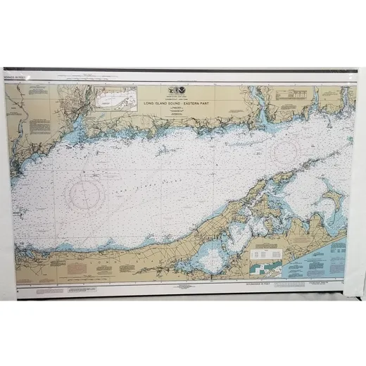
Eastern Long Island Sound Nautical Chart – Artiplaq
This authentic NOAA chart has been custom mounted and is ready to hang. Chart 12354 features the Eastern part of Long Island Sound. Measures approximately 19″ x 12.25″.
Product Specifications
| Feature | Chart Number: 12354 |
|---|---|
| Region Covered | Eastern Long Island Sound |
| Dimensions | 19″ x 12.25″ |
| Material | Artiplaq (premium, durable, non-reflective surface) |
| Mounting | Pre-mounted and ready to hang |
FAQ
Is this chart suitable for navigation purposes?
This chart is an authentic NOAA chart and is suitable for reference and navigation in the Eastern Long Island Sound. It is recommended for boaters and maritime users who require accurate regional information.
What is the material of the chart?
The chart is printed on Artiplaq, a durable, non-reflective material designed for long-term display and protection from environmental exposure.
Can the chart be framed or mounted differently?
The chart is pre-mounted and ready to hang. Custom framing or mounting is not available.



Amy Arnold –
The chart is clear and detailed, showing accurate shoreline and water features. It looks great on the wall and is easy to read during boat trips. The quality of the print and the mounting is solid.
Jan Clarkson –
I use this chart for planning local sailing routes. The detail in the waterways and markers is impressive. It’s a reliable reference for my weekend outings.
Penelope Fraser –
Perfect for a marina or home office. The size fits well in a corner, and the colors are vibrant without being distracting. No fading after several months of display.